- News
- Reviews
- Bikes
- Components
- Bar tape & grips
- Bottom brackets
- Brake & gear cables
- Brake & STI levers
- Brake pads & spares
- Brakes
- Cassettes & freewheels
- Chains
- Chainsets & chainrings
- Derailleurs - front
- Derailleurs - rear
- Forks
- Gear levers & shifters
- Groupsets
- Handlebars & extensions
- Headsets
- Hubs
- Inner tubes
- Pedals
- Quick releases & skewers
- Saddles
- Seatposts
- Stems
- Wheels
- Tyres
- Tubeless valves
- Accessories
- Accessories - misc
- Computer mounts
- Bags
- Bar ends
- Bike bags & cases
- Bottle cages
- Bottles
- Cameras
- Car racks
- Child seats
- Computers
- Glasses
- GPS units
- Helmets
- Lights - front
- Lights - rear
- Lights - sets
- Locks
- Mirrors
- Mudguards
- Racks
- Pumps & CO2 inflators
- Puncture kits
- Reflectives
- Smart watches
- Stands and racks
- Trailers
- Clothing
- Health, fitness and nutrition
- Tools and workshop
- Miscellaneous
- Buyers Guides
- Features
- Forum
- Recommends
- Podcast
£329.99
VERDICT:
A feature-packed, small and impressive update on the popular Edge 810
Weight:
64g
Contact:
At road.cc every product is thoroughly tested for as long as it takes to get a proper insight into how well it works. Our reviewers are experienced cyclists that we trust to be objective. While we strive to ensure that opinions expressed are backed up by facts, reviews are by their nature an informed opinion, not a definitive verdict. We don't intentionally try to break anything (except locks) but we do try to look for weak points in any design. The overall score is not just an average of the other scores: it reflects both a product's function and value – with value determined by how a product compares with items of similar spec, quality, and price.
What the road.cc scores meanGood scores are more common than bad, because fortunately good products are more common than bad.
- Exceptional
- Excellent
- Very Good
- Good
- Quite good
- Average
- Not so good
- Poor
- Bad
- Appalling
The Garmin Edge 820 is a features-packed, compact and neat cycle computer that is a decent update to the popular 810. Perhaps the screen could be a little more responsive and the GroupTrack could be more accessible, but overall it's an impressive piece of kit.
You can read my first thoughts about the latest bike computer in Garmin's 800 series here, with the 820 taking the place of the 810 in the lineup, but I have now had a little more time with the unit and so here is a more thorough rundown.
> Find your nearest dealer here
Size, looks & installation
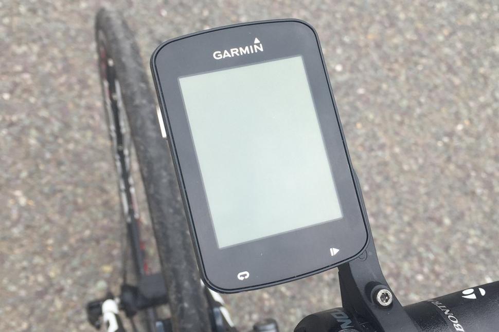
The Edge 820 is 49 x 73 x 21mm – the same size as the 520, which means a smaller screen, something that I was initially sceptical about in terms of being able to effectively use it for navigation. However, this concern was unfounded and it was easily good enough to direct me without needing to go all Froome and stare at the computer from just millimetres away. Certainly, it's not at the same level as the 1000 in terms of navigation purely because of the screen size, but it is more than enough for my needs.
In terms of installing it on the bike, the unit uses the same Garmin mounts as previous units and comes with a couple of stem mounts and one out-front. Fitting them to the bike is easy, with either rubber bands or a quick few turns of an Allen key. One thing that I have always liked about this is that it makes it easy to transfer the computer between bikes when needed without needing to cut cable ties like with other mounts; you can just undo the rubber bands and then redo them on the other bike.
It is aimed at the performance cyclist who also wants to be able to navigate, so isn't as bulky as the 1000, but packs in more features than the 520. In terms of looks, it is almost indistinguishable from the 520 apart from the lack of buttons on the side of the unit. It is a sleek looking and small unit that sits nicely either out front or on the stem without taking up too much bar real estate.
Navigation, operation & screens
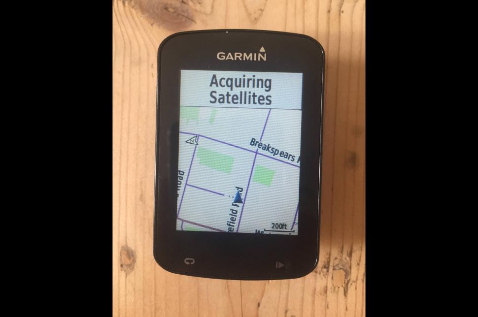
Navigation has been improved with some of the key features from the more expensive and navigation orientated 1000 moving down to the 820, such as round trip routing, allowing the computer to create the route for you. It's a nice touch that worked well for me when I was testing it out in an unfamiliar area and gave me a few route options based on climbing and intensity. It also doesn't require external cards to be inserted for new areas of the world – instead Garmin has included all maps on the unit from the start. To be honest, I didn't use it outside of the UK, but all maps I used were up to date and worked well.
Maps have also been improved with a clearer layout, closer to the kind of thing you would see on a regular sat nav. It makes it easy to see exactly where you are going and there is less incentive to change to a custom mapping layout, which I have done on a couple of older versions.
The screen may not be as big as on the 1000, but turn-by-turn prompts were still simple to follow and despite its small size it was good enough to clearly show me where I was heading, even when I was off course. I found that adding in a postcode, town or specific site was effective and worked well, getting me to the correct place without fuss. That said, I did have a couple of frustrating times with the computer rerouting some pre-planned routes I had; for example, when halfway between London and Brighton I found myself needing to ride two miles on what seemed like an abandoned footpath...
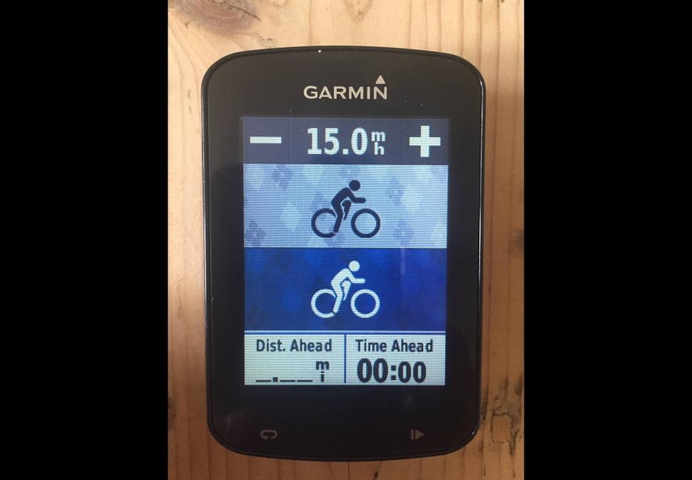
As with other Garmin units you can customise the data you see on each page and then set activity profiles, which means you can switch between different screens for different uses. For instance on my training screen I had seven data fields including time of day, while on my race activity profile I had four data fields, so they were larger and easier to see at a glance. There is also the ghost cyclist screen where you can 'race' against another rider who rides at a constant speed, something that's been included in most Garmins for a while and which I regularly use for training.
Garmin has also added GroupTrack, which allows you to track up to 50 riders within 10 miles of you. Essentially, if you get dropped or lost, you can easily see where others are. This has many uses, but requires others to have compatible Garmin computers and to follow you on Garmin Connect. I managed to test it a couple of times with others in my club and it works well and I could clearly see where people were on the map. You can also see if your friends are out on the road near you, which is a nice touch. However, there are still relatively few people who use the platform compared to something like Strava, but this may change as GroupTrack grows in popularity.
The unit is operated predominantly through touchscreen, but with two buttons at the bottom and the on/off button on the top left. The buttons on the bottom are start/stop and lap, although they also operate as multi-functional on certain screens. The touchscreen works okay, but compared with button-controlled computers and the 1000 it seems a little sluggish, sometimes taking a second to react. However, it worked just as well with touchscreen-enabled gloves and was still usable in the wet, so good in a variety of conditions.
Data recording, uploading & connectivity
The unit comes with a decent amount of connectivity, with ANT+ and Bluetooth meaning it is simple to connect sensors on the bike and smartphones. I used it alongside Garmin's more modern accelerometer based sensors and also the traditional speed/cadence sensors, with both connecting easily and picking them up within a few seconds of starting rides. It also shows notifications and information from your smartphone, with a separate connection for notifications and uploading. This means that you can have one without the other, which saves battery life on both the phone and unit. GPS is also noticeably faster to connect than on the 810 thanks to the inclusion of GPS and GLONASS, meaning more satellites can be used and identified.
It is also usable with Varia devices, including lights and radar. I didn't test it with these features but I was shown them in action by Garmin and they seem to work well with the unit.
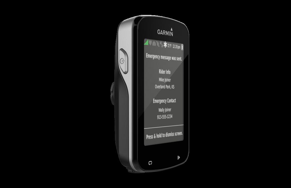
Garmin is also catching up with other bike computers in delivering 'incident detection', which essentially means that a text message and location is sent out to a pre-determined contact number. I tested this once and it seemed to work well, with a text being sent after mimicking a crash, although I would say it would be best to turn it off if it's going to be used off-road as it can be a little sensitive.
Recording was as good as anything I have seen from other GPS computers. There was a little loss when I was riding under cover (trees and tunnels for instance), and among tall buildings it tracks better than the 810 did, but once in a while you can see a bit of an erratic twitch in your recorded route.
> Can't afford it? Read our guide to the best cheap GPS cycling computers
In terms of data on screen, it seems accurate and using it alongside two other computers and a phone, it was quick to note changes in speed and cadence, with gradient also quickly shown. It is actually one of the best gradient recordings I have used, picking up changes when going over short bumps and quickly picking up slight changes on longer climbs.
Uploading from the unit is done through Bluetooth to your smartphone, which is quick and easy through the Garmin Connect app. From there you can either download the file to your desktop or share it with other sites. For instance, it would take roughly a minute from uploading a ride for it to appear on Strava.
Battery life, weight and price
Battery life is claimed to be around 15 hours, which seems about right, but there are also battery saver modes which can help to extend this if you are out on the road and have forgotten to charge the unit. This essentially just turns off the display but keeps recording. There were a couple of times when battery life inexplicably declined and there was little warning of levels, so once or twice it would just turn off mid-ride, which was a little frustrating. Garmin says there is shortly going to be an update to fix this issue.
The unit comes in at a respectable 64g, which is actually less than Garmin's claimed 67.7g. It is about 6g more than the 520, which, bearing in mind it has significantly more features, is impressive. It isn't the lightest computer you will find, but you are unlikely to feel like it's weighing you down on a climb and is nearly half the weight of the 810.
Garmin is offering the 820 with an RRP of £329.99 as a standalone unit, or £60 more with a heart rate monitor thrown in. It is also available in an Explore model, for £279.99, which offers fewer performance measurements, so is predominantly a navigation device. This price seems about right for a full colour, touchscreen device with the kind of capabilities it has.
Conclusions
I have been impressed with the Edge 820. It has as accurate tracking as I have found on a GPS computer, the connectivity is strong and it is simple to use. Perhaps the screen could be a little more responsive, the battery life could be a little better and the GroupTrack could be more accessible (this may change as more people begin to use it), but with the frequent updates we are likely to see from Garmin, these issues are likely to be resolved. All in, it is probably the best performance and navigation computer I have used and that Garmin has been able to pack it all into such a small unit is astounding.
Verdict
A feature-packed, small and impressive update on the popular Edge 810
road.cc test report
Make and model: Garmin Edge 820
Size tested: n/a
Tell us what the product is for, and who it's aimed at. What do the manufacturers say about it? How does that compare to your own feelings about it?
A bike computer aimed at performance riders who want something lightweight and small but also with navigation options.
Garmin says: 'This compact, touchscreen GPS cycling computer offers advanced performance monitoring, bike-specific turn-by-turn navigation, our new GroupTrack feature and more.'
It achieves exactly what it sets out to do, with good connectivity, navigation and a strong data display.
Tell us some more about the technical aspects of the product?
Physical dimensions 73.0 x 49.0 x 21.0 mm
Display size, WxH 58.4 mm
Display resolution, WxH 200 x 265 pixels
Touchscreen
Color display
Weight
67.7 g
Battery Rechargeable lithium-ion
Battery life Up to 15 hours GPS training mode; up to 24 hours UltraTrac mode
Water rating IPX7
GPS-enabled
GLONASS
High-sensitivity receiver
Barometric altimeter
Unit-to-unit transfer (shares data wirelessly with similar units)
Smart notifications (displays email, text and other alerts when paired with your compatible phone)
VIRB® control
Maps & Memory
Basemap
Ability to add maps
Waypoints/favorites/locations 200
Routes 100 (as courses)
History Up to 200 hours
Cycling Features
Compatible with Vector™
Bike speed/cadence sensor Yes (Some versions)
Performance Features
Heart rate monitor Yes (optional)
Virtual Partner® (train against a digital person)
Courses (compete against previous activities)
Auto Pause® (pauses and resumes timer based on speed)
Auto Lap® (automatically starts a new lap)
Auto Scroll (cycles through data pages during workout)
Advanced workouts (create custom, goal-oriented workouts)
Time/distance alert (triggers alarm when you reach goal)
Interval training (set up exercise and rest intervals)
Heart rate-based calorie computation
Calculates calories burned
Customizable screen(s)
Power meter compatible (displays power data from compatible 3rd party ANT+™-enabled power meters) Yes (records data approx. 1 per second)
Temperature (displays and records temperature while you ride)
Shock Resistant
Garmin Connect™
Garmin Connect™ compatible (online community where you analyze, categorize and share data)
Automatic sync (automatically transfers data to your computer)
Additional
Additional
Compatible with Varia™ bike radar and lights: Yes
Edge® remote compatibility: Yes
LiveTrack: Yes
Advanced performance and power analysis, including VO2 max, FTP/Watts/kg tracking, Performance condition/lactate threshold/stress score as well as advanced cycling dynamics, GroupTrack, in-ride challenges through Strava live segments and connected features
Bike trainer profile for compatible Turbo trainer data display and control: Yes
On-device segment compatibility for dynamic and engaging in-ride competition: Yes
Operating temperature: -20°C to +55°C
Connected features via a smartphone: Yes
Compatible with Garmin Connect™ and Garmin Connect™ Mobile: Yes
Integration with Shimano Di2 electronic shifting: Yes
Weather alerts: Yes
Preloaded Garmin cycling map: Yes
Wi-Fi® compatible: Yes
Ambient light: Yes
Round-trip routing: Yes
Route planner: Yes
Incident detection: Yes
Training plans/workouts: Yes
Connect IQ™ store compatible: Yes
Audio prompts: Yes
ANT+™ electronic shifting compatibility: Yes
Rate the product for quality of construction:
8/10
Well made, with a solid feel and high quality materials used throughout.
Rate the product for performance:
8/10
Performed very well, displayed data clearly and navigation works well too.
Rate the product for durability:
8/10
Worked well in the wet without any issues, solid construction suggests it should survive drops.
Rate the product for weight (if applicable)
7/10
Only 6g more than the 520 despite packing in impressive features.
Rate the product for value:
5/10
About right for a high quality bike computer with touchscreen and loads of connected features.
Tell us how the product performed overall when used for its designed purpose
It performed well; perhaps the battery could be better (we have been told there will be an update to fix this) and the screen is a little sluggish, but these are minor issues for what is a strong computer.
Tell us what you particularly liked about the product
The fact that Garmin has managed to pack this much into such a small unit while still making it easy to use.
Tell us what you particularly disliked about the product
The rerouting of a few of my pre-defined routes was a little frustrating.
Did you enjoy using the product? Yes
Would you consider buying the product? Yes
Would you recommend the product to a friend? Yes
Use this box to explain your score
It may have a couple of little issues, but these are relatively simple to fix with updates, and overall it is one of the best bike computers I have used.
About the tester
Age: 27
I usually ride: Cannondale Supersix Evo 6 My best bike is:
I've been riding for: 5-10 years I ride: Every day I would class myself as: Experienced
I regularly do the following types of riding: commuting, club rides, sportives, general fitness riding, fixed/singlespeed, mountain biking
George is the host of the road.cc podcast and has been writing for road.cc since 2014. He has reviewed everything from a saddle with a shark fin through to a set of glasses with a HUD and everything in between.
Although, ironically, spending more time writing and talking about cycling than on the bike nowadays, he still manages to do a couple of decent rides every week on his ever changing number of bikes.
Latest Comments
- ROOTminus1 2 hours 28 min ago
I struggled to find MTB flat shoes that fit my duck-like feet, and buying regular trainers is a pain enough. When I tried to look at road shoes...
- whosatthewheel 3 hours 25 min ago
That pleb's mouth needs getting punched for the foul chat and display of completely unprovoked agression in front of a child.
- captain_slog 6 hours 16 min ago
Nice idea. Il Lombardia: la classica delle foglie morte. Because that name, Lake Como in autumn, Coppi and proper climbs.
- Dnnnnnn 6 hours 24 min ago
It might have stretched to that metre, and I suspect it was only available for active travel capital projects - but the general public just see...
- Bungle_52 7 hours 59 min ago
Well now I've heard the excuses and had time to digest them I'm not impressed to say the least....
- Rendel Harris 9 hours 4 sec ago
Definitely legal and a number of teams have used them, I remember an interview with IPT's chief technician a couple of years back where he revealed...
- slc 9 hours 11 min ago
I cycled up Marsh Lane yesterday, and went through the bus gate behind the new number 16 bus (temple meads to kingswood via barton hill). So that...
- hawkinspeter 10 hours 29 min ago
I share that hope too. I think it's slightly more complicated as the lower courts ordered that he had to be returned and now the Supreme Court have...




Add new comment
25 comments
Ouch. List price in Australia $799.00
I'll keep on using my ancient 705 until it dies completely.
Disappointing that it doesn't bring up the map page when a turn is coming up. That was a really useful feature on the Edge 810 (RIP).
They've added lots of unnecessary cr*p though! VO2 max estimate based on a zone 2 ride anyone?
Received mine this morning, bricked it and had to a hard reset already. Bit of advice: don't whack all your previous .gpx .tcx routes in 'newfiles' like you did on your older units. Seems to run OSM maps fine though.
Not true about the lack of mapping on the 520. You can repalce the very poor garmin base map with 50Mb worth of OpenStreetMap data. There are numerous sites/youTube vids on the web showing you how to do it (http://www.dcrainmaker.com/2013/05/download-garmin-705800810.html). Basically there is a dutch site that allows you to select the map tiles you want and it builds a base map file for you. While you can't get the whole country you can get a good sized area. I have most of Glos, Chelt, Worc, Swindon and Cardiff and when I did the Pyrenees I just swapped it for a base map of that part of the world.
I appreciate it doesn't do the route calculation that the 1000 can do but plotting a route on the likes of RideWithGPS means you get a bread crumb trail overlaid on the fully detailed OSM map with optional turn warnings. I'm not convinced I would ever want the garmin to plot a route for me unless maybe I had a mechanical and needed the fastest route home. You can always just navigate yourself using the map but it can be hard on a tiny screen, when zooming in/out is a fiddle.
Garmin seem to do a great job of building in features that they never tell anybody about or don't bother to produce the software to support. Was the same with the navigation capabilities of the Edge 205. I guess they would rather peopl spend the extra £££ on the higher end units.
If you use Garmin Express when it's plugged in, it will sync data off the 820 and into Garmin Connect (and vice versa). I've not had any issues with the wifi, works fine, although the interface is confusing - you have to trust that it is working!
It mounts as a USB drive on my Mac when plugged in.
Ta for that info, that's good, saves having to use crappy garmin app and seemingly flakey wifi
Anyone know if yan you get data off via usb or only with BT/wifi?
Which out front mount is featured in the photos and is it one of the included ones in the package?
Standard Garmin out front mount. Comes with it and any Garmin head unit these days.
People buy a lot of after market ones because, although the picture doesn't show it clearly, the Garmin mount raises the head unit above the bars. Lots of people prefer it to be more flush and aero so they go K-Edge etc.
That's incorrect.
The one pictured is the first-generation aftermarket one by Garmin that positions the unit in line with the stem. This was designed for use with the Edge 800/810, where the buttons are on the face of the unit.
The one included in the box is the newer version that positions the unit above the level of the stem, so (ostensibly) it's easier to access the bottom-mounted buttons on the Edge 520/820 design.
What with the Edge 520/820 being slightly shorter than the 800/810 you can use the old "inline" version and still happily access the buttons as you can probably gather from the photos; admittedly it might be a bit fiddly with winter gloves, but then again, it's fiddly doing anything in winter gloves.
Had it a month. No crashes or freezes. WiFi upload works perfectly. It just works - had a fair few bike computers and this one works best straight out of the box. Recommended
Question is, is it as buggy and crash prone as the 810?
Have garmin upped their game in terms of testing and quality control, or are they still being lazy sods?
I asked garmin by e-mail if there were plans for an 820 a year ago and they said there was nothing currently planned so i bought a 520, well that was a quick turn around!
Agree the 520 is great but it's so handy uploading routes and seeing them on a proper map.
Great product but i think the 520 is more value than ever. I am a little skeptical about the response of the touch screen. I am using 520 6 months now and have no complaints at all.
The 520 is great if you don't want any mapping - it's ok to follow a breadcrumb, which I've done ok when I had one, but it won't do more than that ie TBT. The 820 should be a distillation of all the good bits of the 1000 now that is pretty well sorted, but instead it has a load of its own problems.
Not true about the lack of mapping on the 520. You can repalce the very poor garmin base map with 50Mb worth of OpenStreetMap data. There are numerous sites/youTube vids on the web showing you how to do it (http://www.dcrainmaker.com/2013/05/download-garmin-705800810.html). Basically there is a dutch site that allows you to select the map tiles you want and it builds a base map file for you. While you can't get the whole country you can get a good sized area. I have most of Glos, Chelt, Worc, Swindon and Cardiff and when I did the Pyrenees I just swapped it for a base map of that part of the world.
I appreciate it doesn't do the route calculation that the 1000 can do but plotting a route on the likes of RideWithGPS means you get a bread crumb trail overlaid on the fully detailed OSM map with optional turn warnings. I'm not convinced I would ever want the garmin to plot a route for me unless maybe I had a mechanical and needed the fastest route home. You can always just navigate yourself using the map but it can be hard on a tiny screen, when zooming in/out is a fiddle.
Garmin seem to do a great job of building in features that they never tell anybody about or don't bother to produce the software to support. Was the same with the navigation capabilities of the Edge 205. I guess they would rather peopl spend the extra £££ on the higher end units.
I've not had any crashes on save via wifi, but have had two random ones but no lost data. As for the Save Ride icon - a floppy disk? WTF were they thinking! Grates every time I have to tap it (or hover above it or tap it repeatedly for anything to happen …). The 1000 just has a Save Ride button, that’s all we need!
Can the device be charged whilst in use, via a usb battery pack or similar?
Afraid not, at least not while mounted - the USB charging point is under the device, where it would attach to the mount, and the device goes into charging mode when plugged in (to a PC at least).
Wifi needs to be smarter than simply on or off. You want the wifi for the auto upload, but you have it on for the whole ride burning your battery for the privilege?
That's not cool. Should come on automatically for say 20 mins or some other duration after you save a ride. Or maybe just a button press to activate the upload via wifi which turns wifi and the unit off after it's done.
It is 'smart' - after the initial connection, it goes to sleep until prompted to wake ie at the end of a ride when it is told to upload if the paired wifi is in range. Otherwise it waits until it is. Unfortunately, this isn't clear from the screen, nor the manual, and so reading of the Garmin forums is required. Here you will also see much complaining about the screen and the elevation issues, amongst others.
This is exactly what it's supposed to do, you can keep the WiFi setting enabled but it'll only actually try to establish a WiFi connection when you first turn the unit on or immediately after you save an activity.
At least that's what is supposed to happen. In reality, what happens is that you press "Save" at the end of a ride, the Edge 820 tries to connect to your WiFi, crashes, corrupts your ride file and leaves you without any data. It's done it to me three times now before and after various factory resets trying to fix it, so now I just make sure Bluetooth is enabled, which bypasses any attempt at WiFi uploads.
Classic new Garmin product. Combined with the Elevation issues mentioned above it really takes the shine off being an early-adopter.
I have one. Uploads can be by wi-fi as well, although the Explore version doesn't have wifi. It has two major issues for many users inc me - the touch screen is a nightmare - way too sensitive or not sensitive at all. The elevation doesn't work at all - on the 1000 you can set an elevation at a location and it will recalibrate. The 820 should be able to do but fails - your picture is a case in point at 376 feet below sea level!
It can upload third party data fields or pages from ConnectIQ - I've tried some and they are ok, but seem to be severely hobbled by what Garmin will allow them to do.