- News
- Reviews
- Bikes
- Accessories
- Accessories - misc
- Computer mounts
- Bags
- Bar ends
- Bike bags & cases
- Bottle cages
- Bottles
- Cameras
- Car racks
- Child seats
- Computers
- Glasses
- GPS units
- Helmets
- Lights - front
- Lights - rear
- Lights - sets
- Locks
- Mirrors
- Mudguards
- Racks
- Pumps & CO2 inflators
- Puncture kits
- Reflectives
- Smart watches
- Stands and racks
- Trailers
- Clothing
- Components
- Bar tape & grips
- Bottom brackets
- Brake & gear cables
- Brake & STI levers
- Brake pads & spares
- Brakes
- Cassettes & freewheels
- Chains
- Chainsets & chainrings
- Derailleurs - front
- Derailleurs - rear
- Forks
- Gear levers & shifters
- Groupsets
- Handlebars & extensions
- Headsets
- Hubs
- Inner tubes
- Pedals
- Quick releases & skewers
- Saddles
- Seatposts
- Stems
- Wheels
- Tyres
- Health, fitness and nutrition
- Tools and workshop
- Miscellaneous
- Cross country mountain bikes
- Tubeless valves
- Buyers Guides
- Features
- Forum
- Recommends
- Podcast
review
£40.00
VERDICT:
An excellent alternative history of the Tour de France centred around 105 years of route maps
Weight:
1,665g
Contact:
At road.cc every product is thoroughly tested for as long as it takes to get a proper insight into how well it works. Our reviewers are experienced cyclists that we trust to be objective. While we strive to ensure that opinions expressed are backed up by facts, reviews are by their nature an informed opinion, not a definitive verdict. We don't intentionally try to break anything (except locks) but we do try to look for weak points in any design. The overall score is not just an average of the other scores: it reflects both a product's function and value – with value determined by how a product compares with items of similar spec, quality, and price.
What the road.cc scores meanGood scores are more common than bad, because fortunately good products are more common than bad.
- Exceptional
- Excellent
- Very Good
- Good
- Quite good
- Average
- Not so good
- Poor
- Bad
- Appalling
There are a lot of books about the Tour de France out there already, and every year more appear. Many of them cover the same ground, but occasionally you come across a different proposition that has been well executed: Cartes du Tour is one such success, and it presents an alternative perspective of le Tour.
- Pros: A history of le Tour as you have never seen it before
- Cons: Not cheap
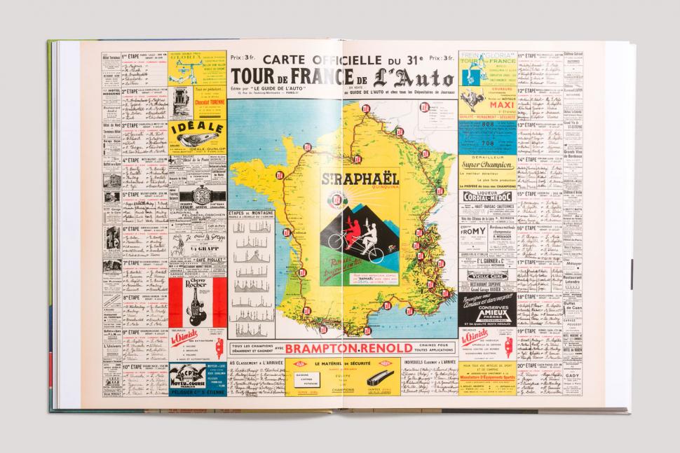
We are all familiar with the overall route map of the event that the organisers of le Tour produce, which much of the media faithfully reproduce; in fact, such is the control over 'le Brand' that one rarely sees anything other than the official (and rather formulaic) Tour map these days. A collection of those going back over the years is naturally included in Cartes du Tour, but you soon realise that they are not the main attraction.
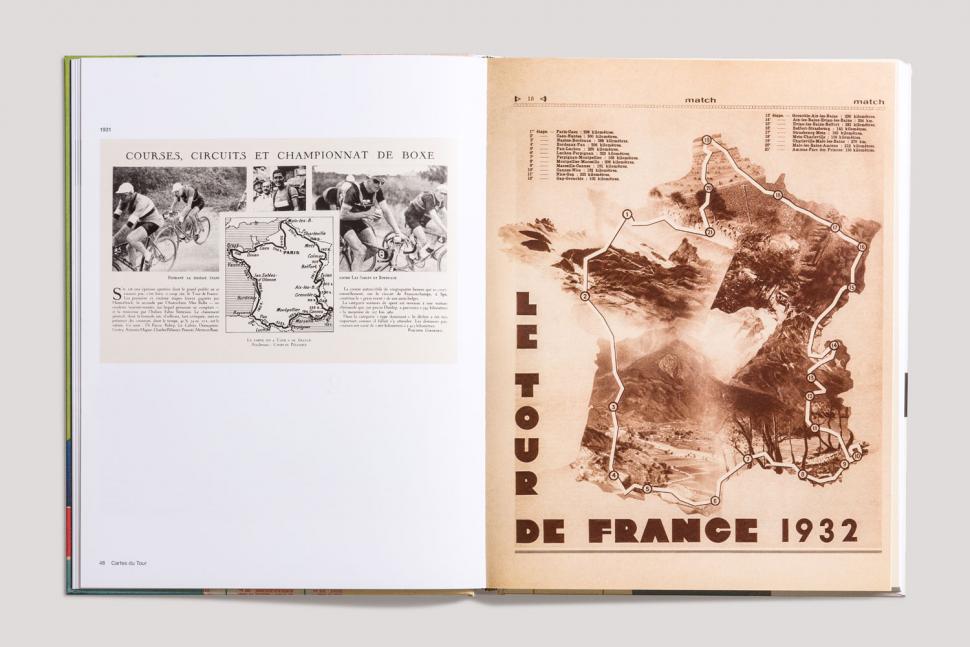
In the 'golden years of cycling through the 60s and 70s' there could be several alternative maps available, as various publications (such as Miroir du Cyclisme) would often take the route information and transpose it onto a base map of their choice. These alternatives make up the bulk of this book – and for good reason: they are so much more varied and interesting than the official offerings. I would welcome similar creativity being allowed today.
The main challenge in putting a book like this together was simply tracking down copies of maps, as there is no central store – not even within the ASO. Fortunately the book's editor, Guy Andrews, has an extensive collection, as have several other 'hoarders' who shared what they had. The entries may vary a bit in quality, but I doubt that you will find a more comprehensive gathering of these historical documents anywhere else.
When you start looking at the maps you quickly notice how much they have changed over the years – and how the routes have changed. At first le Tour really did travel round the perimeter of France (and only France); as transport options improved it became possible to reduce the length of stages, to include the centre of the country, such as the Massif Central, and to hold the Grand Départ outside France.
Looking at the route also reinforces the other changes that have taken place, such as the extent that time trials, team time trials, and split-stage days are used: the short stages and cobbled sections that we have seen over the last few weeks are nothing new.
> Buyer's Guide: 26 of the best books about cycling
There is brief coverage of the Tour de France Feminin, which the ASO ran from 1984 to 1989. It tried to make use of the infrastructure in place for the men's race, much like La Course did this year, but the results were as unfulfilling then as they are today. As Fournel writes, 'A serious Women's Tour, which the riders are crying out for, remains to be created. We must invent its form, its beauty and its economic model.'
Cartes du Tour is a big book, with thick glossy paper, which provides plenty of space to reproduce the maps at a meaningful size; it also allows for the inclusion of Paul Fournel's original writing in French, alongside the translations into English. I am sure this does no harm when trying to get the ASO to support your project – nor does inviting the race director Christian Prudhomme to write the foreword!
Fournel spends very little time on race reports and results in his commentary, which would be unnecessary because they are so well covered elsewhere, but he does throw in numerous interesting snippets of information – such as the first use of the publicity caravan (1930), the first radio broadcast (1938), and the first TV broadcast (1948).
Some of you may be familiar with Mapping le Tour, updated in 2014, which provided 'a route map of every Tour de France', and was originally available in hardback and paperback versions; the difference is that it uses a more conventional map of France, so it does not limit itself to providing information about the race. If you actually wanted to follow the route it would be slightly more helpful, but with a scale ranging from 1:4,000,000 to 1:5,000,000 you still won't have much detail to work with.
One thing that Mapping le Tour has in common with Cartes du Tour is that both show only the planned route, and neither reflect the occasional unexpected deviation on the day: weather or protests can be a cause of such a change, albeit a rare one.
Maps can be a rich source of information by themselves, and in conjunction with Fournel's writing Cartes du Tour provides a rather idiosyncratic history of both the race and the country behind it.
Verdict
An excellent alternative history of the Tour de France centred around 105 years of route maps
road.cc test report
Make and model: Cartes Du Tour by Paul Fournel
Size tested: n/a
Tell us what the product is for
From Rapha Editions:
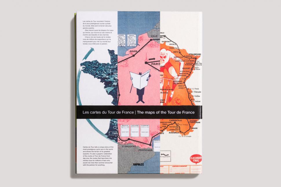
Cartes du Tour tells the unique story of the world's most prestigious cycle race through the medium of its myriad route maps. Carefully curated by Paul Fournel, the maps plot the evolution not only of the race, but also the history of a country which evolves to become more unified and opens itself up to its neighbours. From year to year, the maps always bear semblance yet are continuously changing in accordance with the race itself. Each route, printed in beautiful detail, is a picnic spot of thousands of kilometres for the millions of supporters who flock to the roadside in July. From the very first edition in 1903 to this July's race, the book traces the entire history of the Tour and includes a foreword from Christian Prudhomme, the current director of the race.
Tell us some more about the technical aspects of the product?
Title: Cartes du Tour
Author: Paul Fournel
Publisher: Rapha Editions
Date: July 2018
Format: Hardback
Pages: 248
ISBN: 9781912164042
Price: £40
Rate the product for value:
5/10
£40 is undoubtedly a lot of money for a book, but the quality on offer does go a long way towards justifying it. (You can buy a special edition for £150...)
Tell us how the product performed overall when used for its designed purpose
Reveals a lesser-known aspect of the race in a high-quality package.
Tell us what you particularly liked about the product
Being introduced to the world of alternative route maps.
Tell us what you particularly disliked about the product
Realising that such creativity may not be allowed again.
Did you enjoy using the product? Yes
Would you consider buying the product? Yes
Would you recommend the product to a friend? Yes
Use this box to explain your overall score
An unexpected gem amongst Tour de France books that delivers on its promise of revealing a lesser-known aspect of the race in a high-quality package.
About the tester
Age: 55
I usually ride: My best bike is:
I've been riding for: Over 20 years I ride: Every day I would class myself as: Expert
I regularly do the following types of riding: commuting, touring, club rides, sportives, general fitness riding



I am absolutely certain that it's not fair for trans-identifying males who went through male puberty to compete in female sports... and that should...
I was just excited to learn that Grundig were still a going concern, let alone making stuff for bikes now! What's next, Blaupunkt power meters?!
White shoes:...
Nothing to do with cycling, and currently unclear as to what exactly happened. But a child is dead, a tram line isn't running services and ...
Sidelining the point here a little bit, but I was just looking at a Rapha video about Lachlan Morton's latest incredible venture of riding 648km in...
Or, you can just look at them - it's pretty obvious when they're not going to work with a new chain. Then you can try them with old lengthened...
I bought 5 screw in storage hooks from local d.i.y store for £10. Does the same job 🤷♂️
Well it looks like they've got a page now. It says they'll accept video evidence but I haven't been through the whole process. Looks very similar...
Sorry, but the BBC is definitely tilting towards cycling after the Panorama debacle....
Unlikely. Not once he hears that it'll 'help Gore'.